GPS provides 24-hour navigation services including:
· Extremely accurate, three-dimensional location information (latitude, longitude and altitude), velocity (speed and direction) and precise time
· A worldwide common grid that is easily converted to any local grid
· Passive all-weather operations
· Continuous real-time information
· Support to an unlimited number of users and areas
· Support to civilian users at a slightly less accurate level than cryptographically keyed users
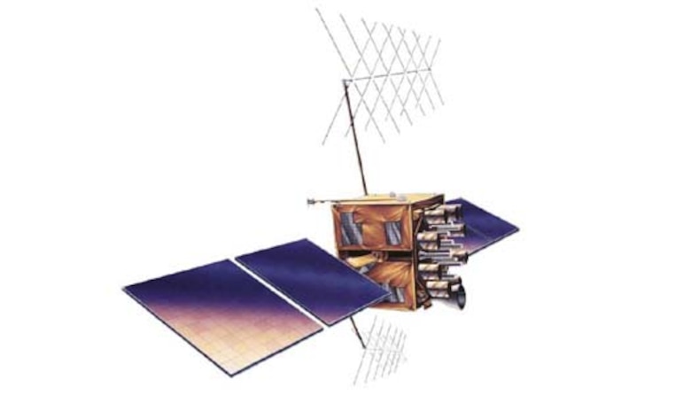
The GPS constellation is designed and operated as a 24-satellite system, consisting of six orbital planes, with a minimum of four satellites per plane.
The Evolved Expendable Launch vehicle is used to launch GPS satellites from Cape Canaveral Air Station, Fla., into nearly 11,000-mile circular orbits. While circling the earth, the systems transmit signals on two different L-band frequencies. Their design life is 10 years for Block IIR/M (but many are lasting longer), 12 years for Block IIF, and 15 years for Block III.
Background
The GPS Master Control Station, operated by the 50th Space Wing’s 2nd Space Operations Squadron (SOPS) at Schriever, is responsible for monitoring and controlling the GPS satellite constellation. The GPS-dedicated ground system consists of six USAF dedicated monitor stations and four dedicated ground antennas located around the world. The monitor stations use GPS receivers to passively track the navigation signals on all satellites. In 2007, GPS added 10 more shared monitor stations (part of the National Geospatial-Intelligence Agency — NGA network of monitor stations) increasing the overall accuracy of the system to all users. Information from the monitor stations is processed at the master control station and used to update the satellites’ navigation messages.
The master control station crew sends updated navigation information to GPS satellites through ground antennas using an S-band signal. The ground antennas are also used to transmit commands to satellites and to receive state-of-health data (telemetry).
The GPS Program Office is working to enhance many of the capabilities provided by the current satellites and user equipment. In April, 2014 the pre-operational broadcast of navigation messages began for additional civil signals (L2C and L5). Additionally, the next generation of GPS will provide increased signal accuracy and reliability, improved anti-jam capabilities, and a fully operational military code capability. Applications such as mapping, aerial refueling and rendezvous, geodetic surveys, and search and rescue operations will benefit from these enhancements.
GPS capabilities were put to the test during the United States’ involvement in Operations Desert Shield and Desert Storm. Allied troops relied heavily on GPS to navigate the featureless Arabian Desert. During operations Enduring Freedom, Noble Eagle and Iraqi Freedom, GPS contributions increased significantly. During OIF, the GPS satellite constellation allowed the delivery of 5,500 GPS-guided Joint Direct Attack Munitions with pinpoint precision (to about 10 feet) and with minimal collateral damage. This was almost one-fourth of the total 29,199 bombs and missiles coalition forces released against Iraqi targets. GPS continues to fill a crucial role in air, ground and sea operations guiding countless service members and equipment to ensure they are on time and on target.
Air Force Space Command’s Space and Missile Systems Center at Los Angeles AFB, Calif., acts as the executive agent for the Department of Defense lead for acquiring GPS satellites and user equipment.
General Characteristics
Primary Function: Positioning, navigation, timing and velocity information worldwide
Primary Contractors: Block II/IIA, Rockwell International (Boeing North American); Block IIR, Lockheed Martin; Block IIR-M, Lockheed Martin; Block IIF, Boeing North American; Block III vehicles 1-10, Lockheed Martin
Power Plant: Block IIR/M solar panels generate 1040 watts; Block IIF panels generate 2450 watts; panels on Block III vehicles 1-10 generate 4,480 watts
Weight: Block IIR/M, 4,480 pounds (2,217 kilograms); Block IIF, 3,758 pounds (1,705 kilograms); Block III vehicles 1-10, 5,003 pounds (2,269 kilograms)
Block IIR/M, 70 inches (1.7 meters); Block IIF, 98 inches (2.4 meters); Block III, 134 inches (3.4 meters)
(includes wingspan) Block IIR/M, 449 inches (11.4 meters); Block IIF, approximately 116 feet (35.5 meters); Block III vehicles 1-10, 538 inches (13.7 meters)
Point of Contact: Air Force Space Command, Public Affairs Office; 150 Vandenberg, Suite 1105; Peterson AFB, Colo. 80914-4500;
DSN 692-3731 or (719) 554-3731 (Current as of November 2016)


.jpg)