NOTE: Please watch the YouTube video “Coastlines Under Attack – Storm Surge Artificially Created”
http://www.irena.org/documentdownloads/publications/wave-energy_v4_web.pdf

http://www.irena.org/documentdownloads/publications/wave-energy_v4_web.pdf
https://cfpub.epa.gov/ncer_abstracts/index.cfm/fuseaction/display.highlight/abstract/8093/report/F
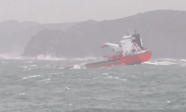
LOS ANGELES — California’s aggressive pursuit of an electric grid fully powered by renewable energy sources is heading in a new direction: offshore.
On Friday, the U.S. Interior Department took the first steps to enable companies to lease waters in Central and Northern California for wind projects. If all goes as the state’s regulators and utilities expect, floating windmills could begin producing power within six years.
Such ambitions were precluded until now because of the depths of the Pacific near its shore, which made it difficult to anchor the huge towers that support massive wind turbines.
ttps://www.bendbulletin.com/business/6611769-151/wind-farms-might-be-rising-off-the-california
https://www.wanttoknow.info/documents/project_seal.pdf
Extracted from Secrets & Treasures: Our stories told through the objects at Archives New Zealand by Ray Waru (Random House)
—————
Since the devastating tsunami wrought havoc across Indian Ocean in 2003, and another deadly wave killed thousands along the coast of Japan in 2011, the very thought of harnessing the destructive force of a tsunami as a weapon of war might be condemned as megalomania or simply dismissed as silly science fantasy.
But in 1944 that is exactly what scientists were trying to achieve off the Whangaparaoa Peninsula in the quiet upper reaches of Auckland’s Hauraki Gulf.
This was New Zealand’s best kept military secret, a mass destruction alternative to atomic weapons: Project Seal, the top-secret plan to build a tsunami bomb.
Today Shakespear Bay, north of Auckland, is a popular weekend spot for windsurfers, paddle boarders and visitors to the resident population of peacocks, but during the last years of World War Two the tranquil waters trembled with the concussion of almost 4000 test explosions.
Project Seal was a highly classified experiment to test the feasibility of destroying coastal defences, even cities, by producing a huge artificial tidal surge, a tsunami.
The idea was conceived by an American naval officer, Commander E A Gibson, after he observed that blasting operations to remove submerged coral reefs around Pacific islands sometimes produced an unexpectedly large wave.
He communicated his idea to the New Zealand Chief of General Staff, General Sir Edward Puttick, who took the concept to the New Zealand War Cabinet.
Tests off Noumea
Agreement was reached for a combined group of Americans and New Zealanders to conduct preliminary tests in New Caledonia. This was done off the coast of Noumea in February 1944.
Included in the group was acting New Zealand director of scientific developments, Auckland University, Professor T D Leech, the prominent local scientist who would later lead the research in New Zealand.
A report made to the US Pacific commander Admiral Halsey after the preliminary tests was so encouraging that he asked New Zealand to undertake further investigations in our waters.
Although couched in military officialese, Halsey’s memorandum to the New Zealand chief of staff beams at the possibility of swamping enemy settlements with a huge, man-made tidal wave. He writes:
“The results of these experiments, in my opinion, show that inundation in amphibious warfare has definite and far-reaching possibilities as an offensive weapon.
“It would be very desirable to have further developments carried out to establish a practicable method and procedure which could be used in offensive warfare.
“I would be grateful if this development could be continued to completion by New Zealand officers. All practicable assistance of facilities and personnel in this command will be at your disposal.”
On May 5, 1944, the New Zealand War Cabinet took up the request and established an Array Research Unit under Professor Leech to conduct top-secret tests for a possible new bomb.
Around 150 people were assigned to the unit, which would use a fortress site on the Whangaparaoa Peninsula, just a short drive from Auckland.
Most of the work would be done by New Zealand engineers, but explosives and ordinance were provided by the US Navy.
Specialised equipment
A large amount of specialised equipment needed to be developed for the project, including remote-wave recording devices, radio-controlled firing mechanisms and specialised marine explosives.
During the experiments a number of British and American scientists interested in triggering deep-sea explosions were invited to observe the work as it progressed.
The Seal project commenced operations on June 6 ,1944, and continued until it was eventually closed down on January 8, 1945.
During that time about 3700 experimental explosions were carried out, with charges ranging from just a few grams to almost 300kg. TNT was the explosive of choice but sometimes nitro-starch or old-fashioned gelignite was used.
Initially, the research was conducted under a false assumption. British studies on deep-sea charges had suggested that the gas bubble from an underwater explosion would work best to produce “an offensive inundation” when the bomb was very deep.
This was proved wrong after the Project Seal tests showed that the best waves would be produced when the charge was set off close to the surface.
Project Seal also proved that single explosions would not generate a wave large enough to cause surf, let alone inundate and destroy enemy coastal defences.
Detonated in unison
To achieve efficient wave production with sufficient destructive force a number of charges had to be detonated in unison.
The boffins in the Hauraki Gulf determined that a line or array of massive charges totalling as much as two million kilograms, split up into 10 or so equal parts, detonated around 8km from shore, would produce a wave of 10-12m in height.
One problem that the programme discovered was that the depth at which the explosive was placed was critical: even a small deviation from optimum would rob the wave of energy and the tsunami would be a ripple rather than a roar.
Initially, the tsunami bomb was seen as having the same offensive potential as the atom bomb, which was still being secretly developed in the United States.
However, at the beginning of 1945 the Allies appeared to be winning the war in the Pacific and the operational priority of the Seal project was reduced.
When the project was closed down in early 1945 the experimental programme was incomplete and the full military potential of the weapon had yet to be realised.
The tests were considered largely successful, however, and in 1947 Professor Leech was invited by the US Assistant Secretary for the Navy to help with the analysis of data from the US nuclear tests at Bikini Atoll.
As late as the 1950s, postgraduate engineering students at Auckland University College were still working on the final summary on the 1940s experiments.
When it was completed, the report called The Generation of Wave Systems tabulated and analysed the statistical and scientific data from Project Seal and it remains today an interesting handbook of how to make waves.
In recent years, Project Seal has attracted the attention of an organisation usually associated with UFO research.
Huge deception
James Carrion from MUFON, the Mutual UFO Network group, has suggested that the project may have been a huge deception intended to deceive the Soviet Union into thinking that the United States had something even bigger in its arsenal than the atomic bomb.
He suggests it could have been used to unmask spies or distract the Soviets into wasting time chasing a frivolous or nonexistent programme.
Whatever the truth about Project Seal, it was one of the most top-secret missions ever conducted in New Zealand territory, and had it been successful may have provided mankind with yet another method of mass destruction.
From the perspective of current New Zealand attitudes to nuclear weapons, it seems almost inconceivable that the country was ever involved in the development of a weapons system that was intended to deliver destruction on such a massive scale.
The secret Project Seal documents were recently declassified, but many are still undergoing a vetting process and they remain restricted, still secret in the vaults of the archive.
ABOUT THE AUTHOR: Ray Waru has been involved in the television and radio industries for more than 30 years. He joined TVNZ in 1977 and directed and produced such local favourites and Fair Go and Country Calendar. This is his first book.
It’s not now that the Bay is feared. It has been an “age old story dating back to the beginning of the Second World War”. Located between France and Spain, the bay has been dangerous and often feared. The German U-boats ruled the Bay and many British and American ships were reported sunk that entered her waters. There were as many as 15,000 casualties and another 5,000 ships that sunk. Despite the danger faced by the ships, they had no choice but to take the route so as to reach with supplies as well as troops to France.
Located in the Celtic Sea, a gulf of the northeast Atlantic Ocean is called the Bay of Biscay. It is located in the northern coast of Spain and the western coast of France and is named after the Spanish province of Biscay. The average depth of the bay is 1745 meters and the maximum depth is 2790 meters and parts of the continental shelf extend into the bay those results into fairly shallow water at places.
Some of the fiercest weather conditions of the Atlantic Ocean can be witnessed in the Biscay Bay. The area is home to large storms during the winter months and there have been countless ships wrecks reported from the area as a result of the gruesome weather. The late spring and the early summer in the area are cool and cloudy and large fog triangles fill the south-western part of the inlet.
The weather in the Bay of Biscay is the most vital thing to be worried and talked about. As winters begin, the weather turns harsh and severe. Depressions are formed and enter the bay from the west. They eventually dry out and are born again in form of thunderstorms. They also bring in constant rain in the region often bringing thunderstorm that look like hurricane and crash at the bay. One such example can be the Klaus Strom.
 Photograph by Sohit Shukla
The Bay of Biscay has always been feared by the seamen. There have been several incidents reported of merchant vessels loosing direction in Biscay storms. At few instances lives have been lost as a result. However, with improved ships and other amenities, the accidents have been reduced to considerable amounts.Ships going to the Mediterranean chose options like the French river rather than taking the route from Biscay Bay due to the legendary reputation of the bay. Many times, the Atlantic swells form near the coasts and often make many ports inaccessible.
There have been quite a few incidents in the recent years of ships facing difficulties, sometimes resulting in grave consequences. In May 2000 two yachts faced disastrous journey even when they left with no signs of bad weather in the Bay of Biscay.
It’s not now that the Bay is feared. It has been an age old story dating back to the beginning of the Second World War. Located between France and Spain, the bay has been dangerous and often feared. The German U-boats ruled the Bay and many British and American ships were reported sunk that entered her waters. There were as many as 15,000 casualties and another 5,000 ships that sunk. Despite the danger faced by the ships, they had no choice but to take the route so as to reach with supplies as well as troops to France.
Additional Info
Various kinds of Dolphins and whales are seen in the waters of Bay of Biscay. Another commonly found animal species are Cetaceans. The greatest area to spot larger cetaceans lies in beyond the continental shelf, in the deep waters. Other seabirds can also be seen across the bay. The alga Colpomenia peregrina was found and first noticed in the bay way back in 1906.
https://discovermagazine.com/2004/jul/rogue-waves

Courtesy of NOAA HIGH WATER Off the coast of North Carolina, a ship is nearly engulfed by storm-tossed seas. Physicists now know that unstable conditions often give rise to waves that are freakishly large yet surprisingly predictable. |
Alfred Osborne’s style is not to do one thing at a time. At the moment he is trying to get a major wave experiment going at a huge tank in Trondheim, Norway. But his PC refuses to communicate with his Mac. And while he’s working on that, he’s trying to revise some formulas that will drive the waves in the tank. His young colleagues from Turin, Italy—Miguel Onorato and Carlo Brandini, both unshaven, uncombed, and turned out in travel-worn attire—make suggestions in Italian, then pass Osborne a pen and a paper full of equations. He answers in English, redoes the equations, and passes back the pen and paper. They respond in English. He answers in Italian with a Texas twang. It’s a bit as if they were in the middle of a Sergio Leone spaghetti western—only this film is called A Fistful of Formulas. The intense man with silvery hair and blue eyes has the Clint Eastwood role, and he doesn’t need dubbing.
Osborne is a long way from home—or homes. There is the one in Texas, where he was born and once worked for NASA; the one in Virginia, where he worked at the U.S. Office of Naval Research; and the one in Turin, where he teaches at the University of Torino and his wife and children live. He is in Trondheim to make waves. Big waves. The kind made famous in The Perfect Storm that sink ships and drown sailors, many of them in the cold North Sea that stretches southwest of the Trondheim waterfront. Called rogues or freaks, such waves are the stuff of mariners’ nightmares—towering, steep-faced walls of water that weigh millions of tons. Waves so unexpected they leave no time for escape, so powerful they can take out even supertankers and oil rigs.
https://en.wikipedia.org/wiki/List_of_rogue_waves
Jump to navigationJump to search

The Draupner wave, a single giant wave measured on New Year’s Day 1995, finally confirmed the existence of freak waves, which had previously been considered near-mythical.
This list of rogue waves compiles incidents of known and likely rogue waves – also known as freak waves, monster waves, killer waves, and extreme waves. These are relatively large and spontaneous ocean surface waves that occur in deep water, usually far out at sea, and are a threat even to large ships and ocean liners.
Anecdotal evidence from mariners’ testimonies and damages inflicted on ships have long suggested rogue waves occurred; however, their scientific measurement was only positively confirmed following measurements of the “Draupner wave“, a rogue wave at the Draupner platform, in the North Sea on 1 January 1995. During this event, minor damage was inflicted on the platform, confirming that the reading was valid.
In modern oceanography, rogue waves are defined not as the biggest possible waves at sea, but instead as extreme sized waves for a given sea state.
It should be noted that many of these encounters are only reported in the media, and are not examples of open ocean rogue waves. Often a huge wave is loosely denoted as a rogue wave, when it is not.[citation needed] Although extremely large waves offer an explanation for the sudden, inexplicable disappearance of many ocean-going vessels. However, although this is a credible explanation for unexplained losses, the claim is contradicted by information held by Lloyd’s Register.[1][2] One of the very few cases where evidence suggests a freak wave incident is the 1978 loss of the freighter München.
In 1991, the American fishing boat, Andrea Gail, was caught in a storm near the NE Atlantic coase of the USA. Junger reported that the storm created waves in excess of 100 ft (30 m) in height, but ocean buoy monitors recorded a peak wave height of 39 feet (12 m), and so waves of 100 ft (30 m) were deemed “unlikely” by Science Daily.[4] However, data from a series of weather buoys in the general vicinity of the vessel’s last known location recorded peak wave action exceeding 60 ft (18 m) in height from October 28 through 30, 1991.[2]
|
|
This section needs additional citations for verification. (August 2009) (Learn how and when to remove this template message)
|
Jump to navigation Jump to search
The rogue wave theorem [1] suggests that a rogue wave in the ocean can be formed whenever:
a) there is a momentaneous surplus of energy perturbed on the momentum or in the kinetic term of a wave train, induced either by a sudden change in the atmosphere leading to strong winds appearing suddenly over large volumes of water.
b) there is a collision of large volumes of water with highly different temperatures and densities.
c) there is a constructive overlap of waves, in opposite directions, in traverse directions or running in the same direction, and the duration of the rogue wave is determined, when occurring in the same direction, by the slight deviations in the momenta of the overlapping waves.
